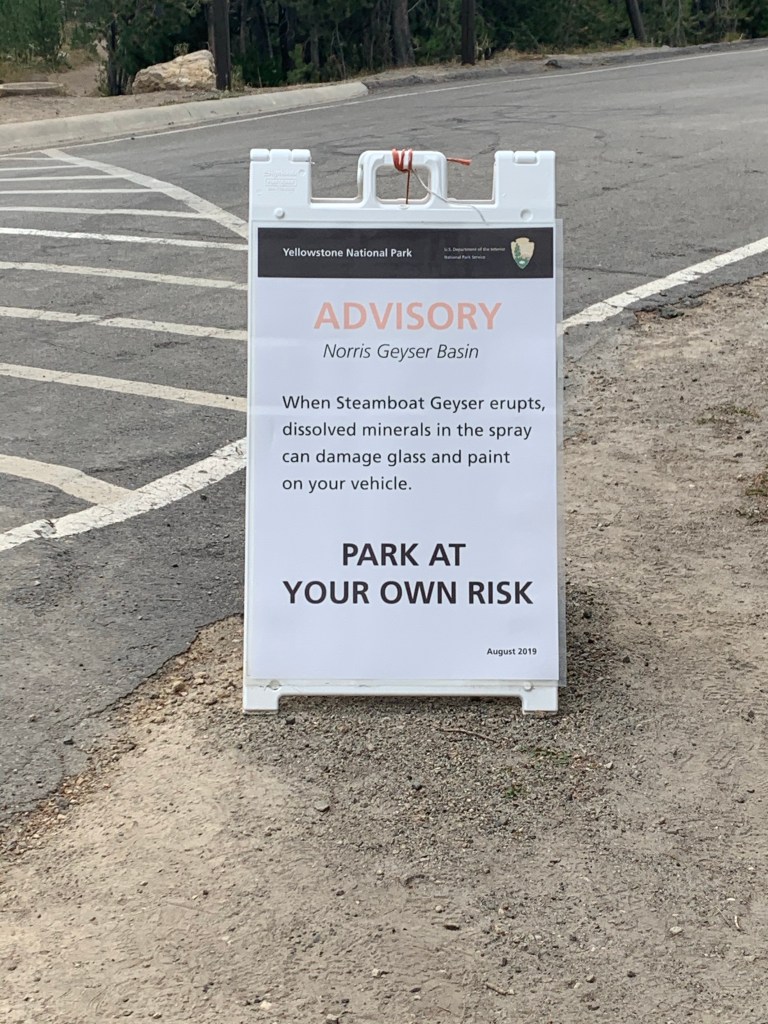
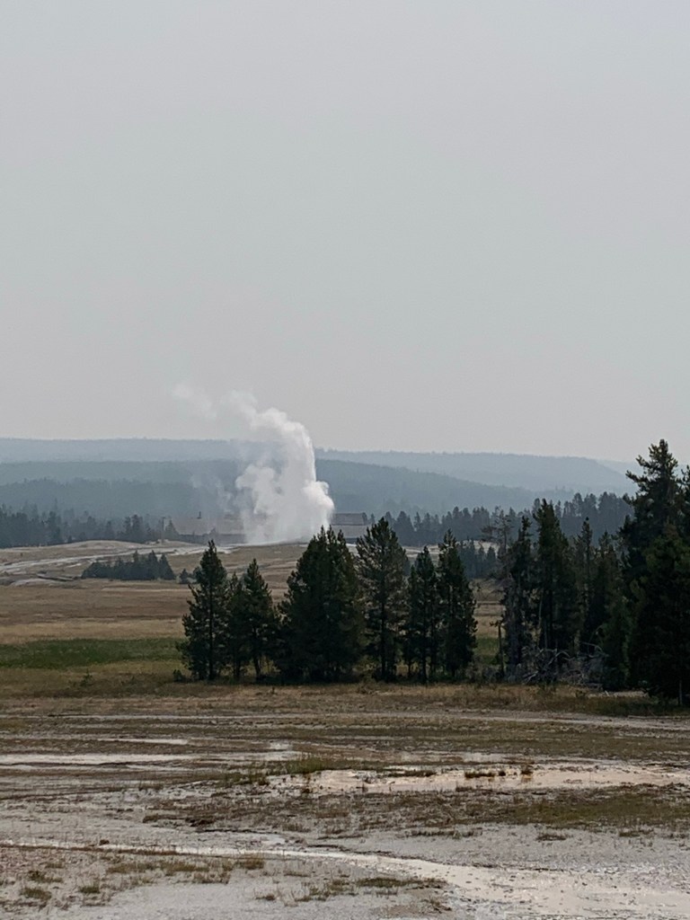
I don’t recall going to the Norris Geyser Basin last time I was in Yellowstone. Sure, it’s another set of geysers in a park that has thousands of them, but this basin has a geyser called Steamboat that has such a large eruption that it sends water into the parking lot.
Comforting
Steamboat goes off roughly every 8 days. It very well could’ve been its day because several cars were covered with tarps and people were camped out at the geyser viewing platform in chairs that they hauled up there. I’m pretty sure if the geyser that can strip paint from my car goes off, I do NOT want to be sitting 10 feet from it when it does. We didn’t stop to watch.
Norris Geyser Basin
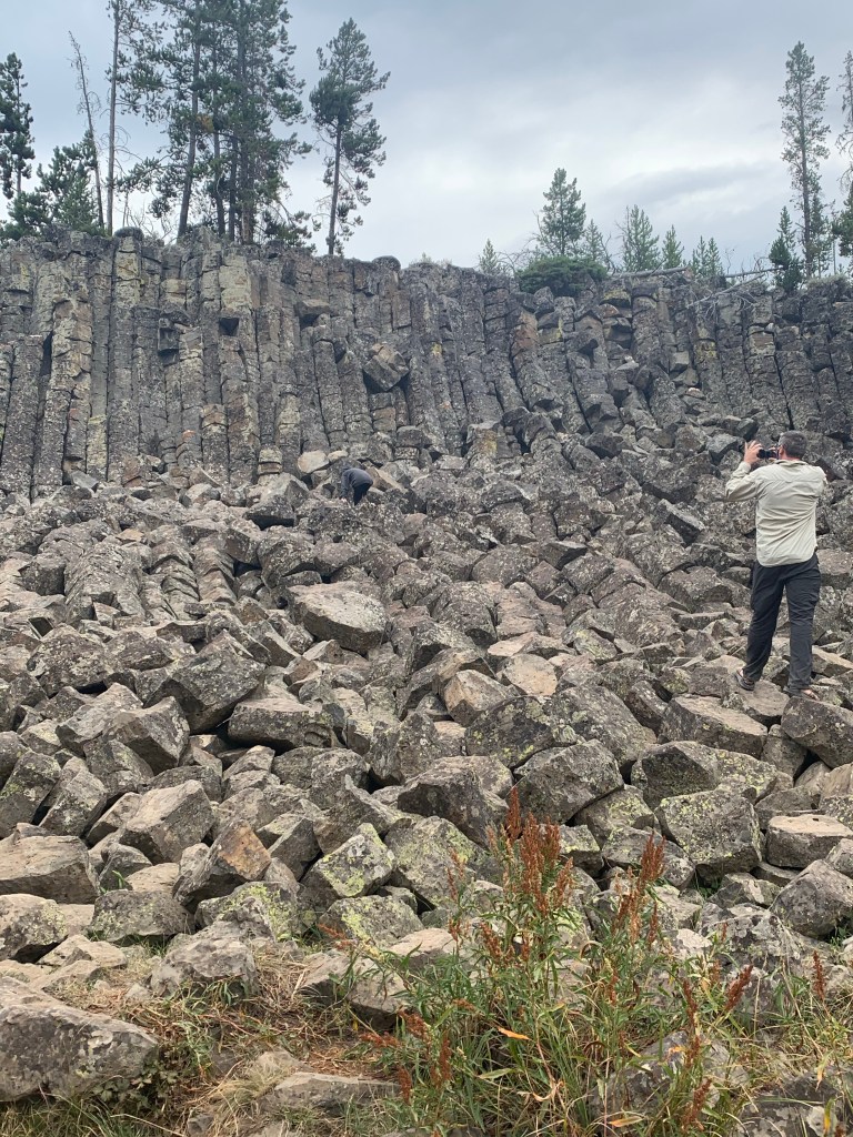
We drove along to find a nice spot for lunch. Sheepeater Cliffs are hexagonal basalt columns (like Giant’s Causeway in Northern Ireland but much, much smaller). Anna-Sophia enjoyed climbing around on the rocks for a while. Sometimes her agility surprises me.
Anna-Sophia, doing her best mountain goat impression (apparently in camouflage with her black and grey clothing)
I absolutely adore Yellowstone National Park. I can see why it was the nation’s first national park, and I truly believe it is one of this country’s greatest treasures. Everybody should make an effort to go there at least once in their lifetime.
The road between Old Faithful and West Thumb (basically where we were staying) was closed due to a forest fire after an unfortunate lightening strike. Since we didn’t know when (or if) the fire would be brought under control, we reworked our plan and instead got up early and high-tailed over to Geyser Country to make sure that we got to see the sights there.
Since it was a long drive around to the geysers, we decided to let Anna-Sophia sleep while we drove. Unless we saw a bear, we weren’t going to pull over, and so we moved right past the half a dozen elk grazing and the herd or bison along the side of the road, knowing there would be plenty more. Humorously, it ended up taking quite some time for us to encounter more so Anna-Sophia started to think we told tall tales about the frequency of animal sightings in Yellowstone. More on the critters later…
Old Faithful geyser
We’ve been listening to Bill Bryson’s A Short History of Nearly Everything while driving. I knew that he covers Yellowstone about 2/3 of the way through the book and I had to wait until after we left the park to get to that part lest I stress myself out at the thought of what makes Yellowstone what it is. The thinking part of my brain understands that geysers, mud pots, and hot springs are not magical creations but rather the result of volcanic geological activity, but I can certainly file those thoughts away for a bit while I marvel at the beauty of the place.
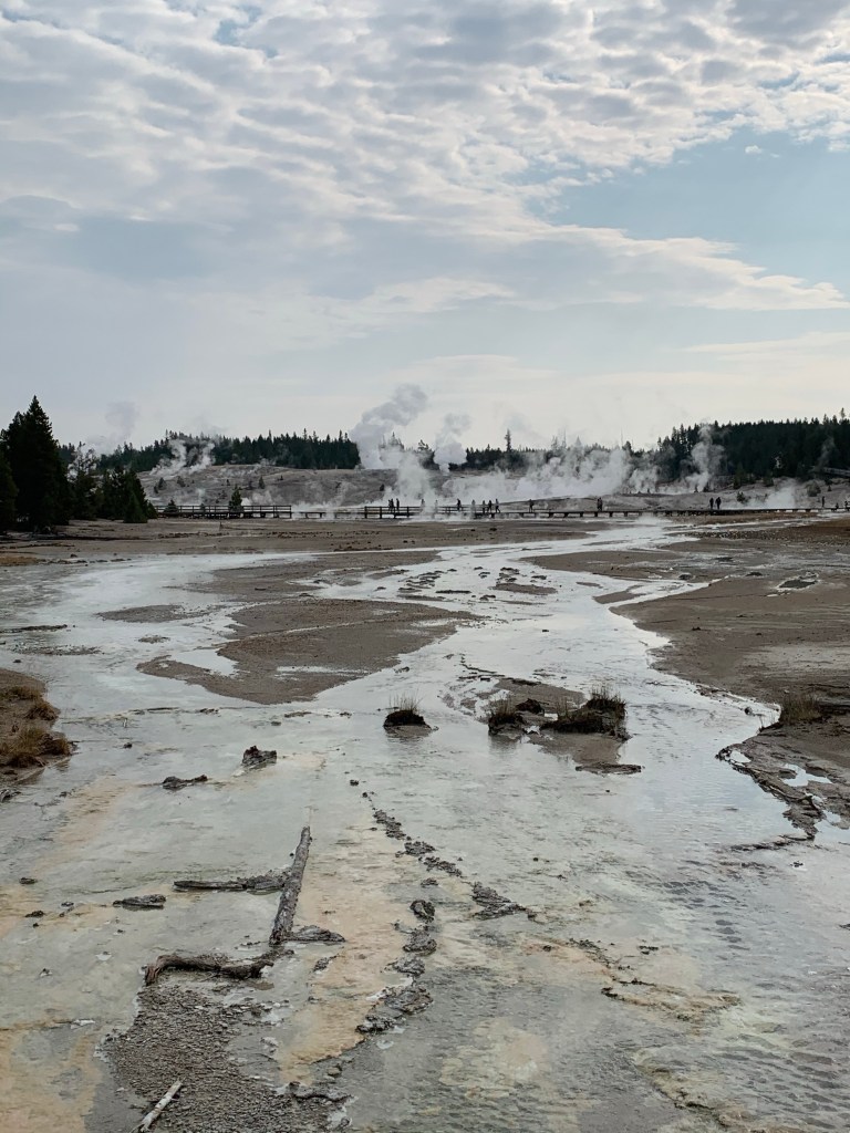
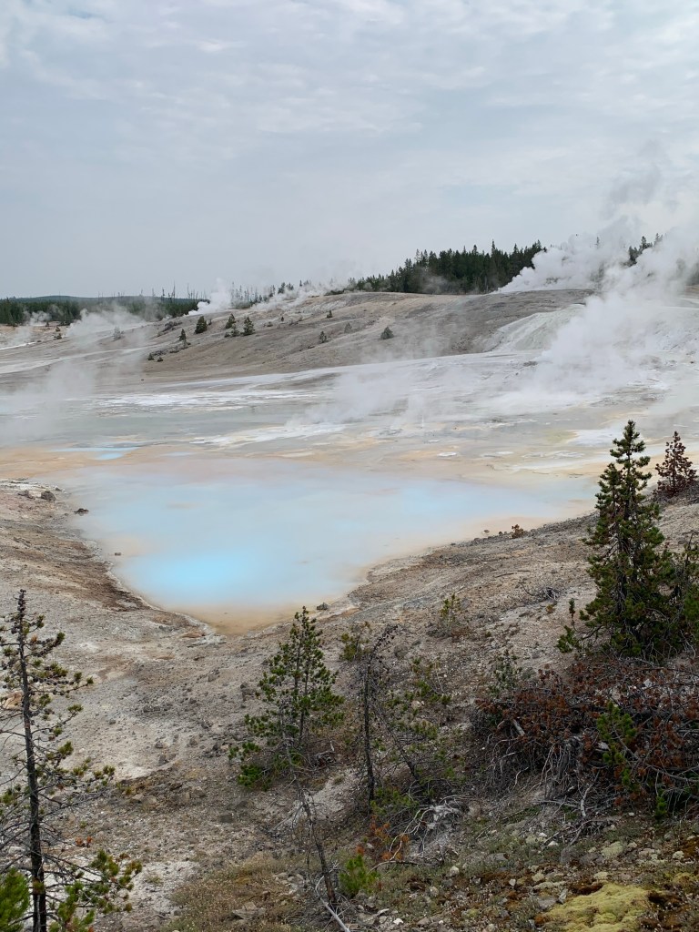
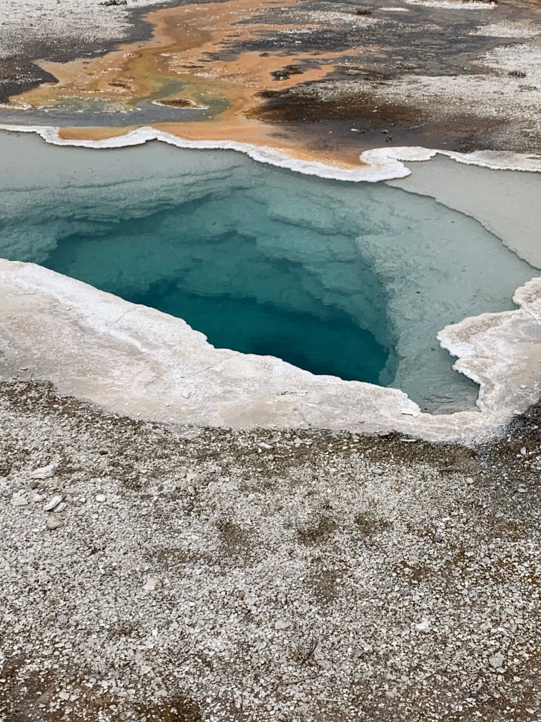
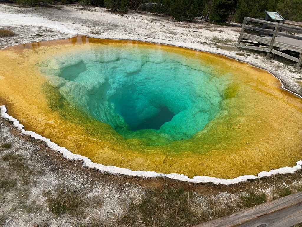
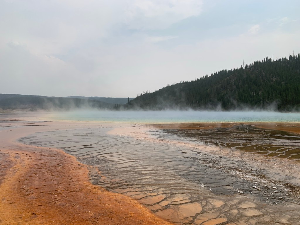
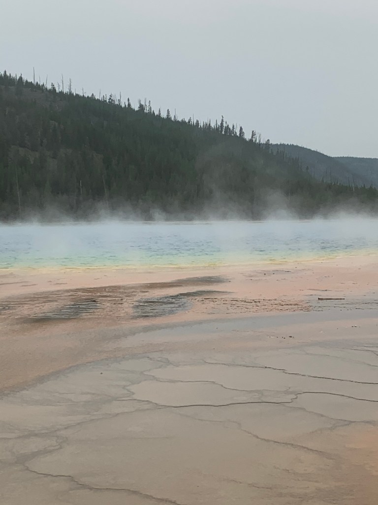
Some random spring/geyser – they all blur together over timeMorning Glory spring…we should’ve taken bear spray with us on the walk out there! No bear, thankfully.Grand Prismatic SpringGrand Prismatic Spring
There’s a weird confluence of hot steam from the spring and the cold surrounding air that rushes in right after it. The steam and the cold air can feel like they hit you simultaneously, so you can feel sweaty and have goosebumps at the same time. Icy-hot, as Anna-Sophia described the sensation. Only in Yellowstone.
Camping that night was in Canyon campgrounds. That place is HUGE. We were a million miles from the visitor center or any other amenity, but we were tired and so sleep was not elusive.
Probably the whole state based on the amount of smoke in Salt Lake City.
We were worried about the smoke ruining our time up north, but decided to push on through since it looked less smoky in Yellowstone and the weather was supposed to clear in a few days.
So after getting the repaired RV back, we hit the road toward Wyoming. Know what Wyoming has little of? People. Towns. Cell service. So we ended up buying an old school paper map to help us navigate our course. I have to admit, I really love a paper map. Phones are super convenient, of course, but there’s something about unfolding the awkwardly large paper map to plot a course that I enjoy. Exploring funny town names, following the course of a river through multiple states, concocting ways to get from A to B that look interesting, scenic, or different…these are things that Google maps just can’t capture in the same manner as a good old map. $7 well spent as I’ve gotten much amusement from that map.
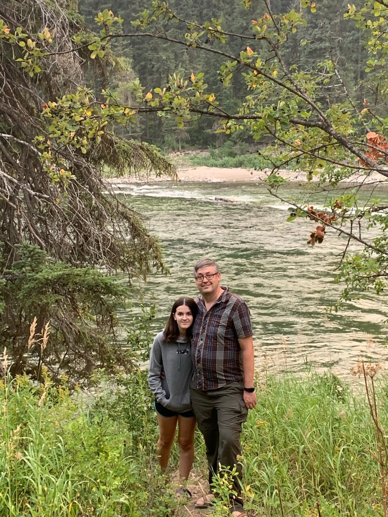
After nearly 6 hours of driving, we found a campsite along the Snake River in Wyoming, just over the border from Idaho.
This was the first time I’d gone camping without reserving a site in advance. I didn’t realize how many campgrounds the Forest Service maintains, and I didn’t know how easy it would be to find one. Worst case, I knew that we could pull over almost anywhere in a National Forest and camp, but in bear country there is something appealing about being with other people. In the end, it was actually super easy to get a site (although I’m glad we arrived when we did – within an hour of our arrival the place was full).
Luke & Anna-Sophia by the Snake RiverNow we know we are in Wyoming!
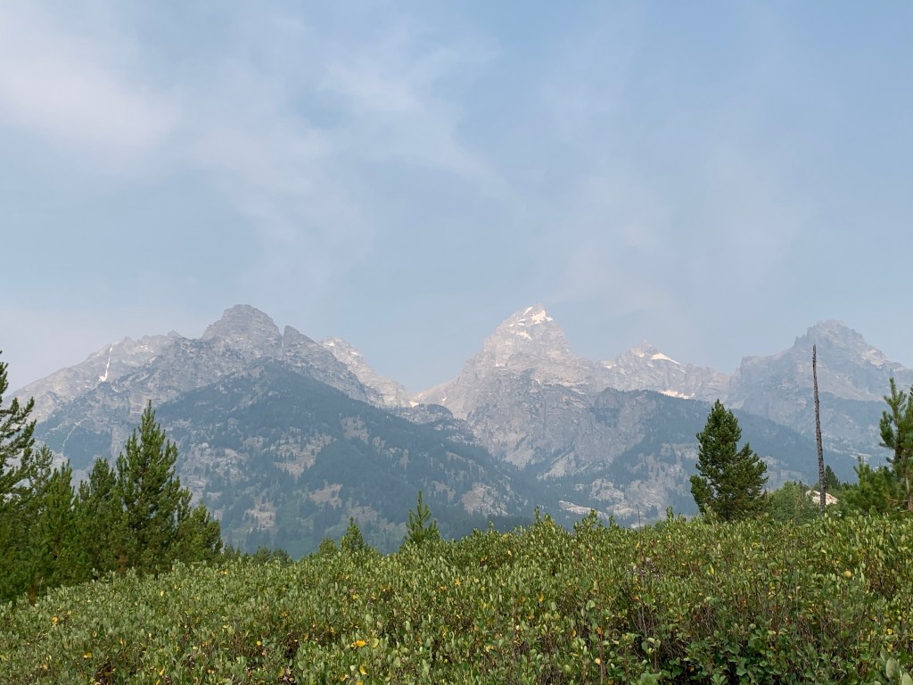
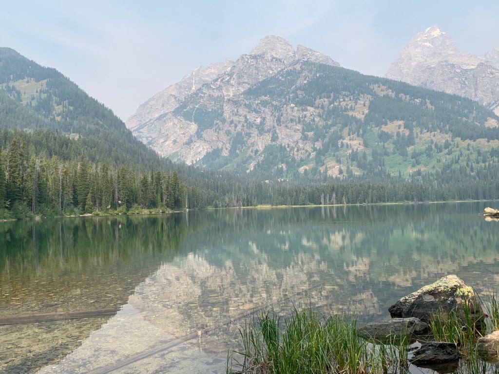
Next on the agenda: Grand Teton National Park. I don’t recall being terribly impressed by Grand Teton National Park last time I went, and the same is true this time (but the location along Yellowstone’s southern entrance makes it hard to skip entirely). The Tetons are impressive mountains, and I am sure if I enjoyed mountain climbing I’d be more impressed by them, but as a sea-level gal, they just aren’t quite my thing. The smoke did nothing to help their cause. I enjoyed seeing them, but I wouldn’t make the trip all that way to Wyoming just for the Tetons.
Tetons, slightly obscured by smoke from the California fires
We did put in about 4 miles of hiking out to Taggart Lake. It was well worth it, as nothing rivals the beauty of a mountain lake. This lake had an emerald hue that was particularly striking.
The Tetons reflected off Taggart Lake
It was also on this hike that I first heard others in my party express an interest in doing more hiking and camping at home. Especially now that we have a base camp alongside the White Mountain National Forest, there are countless options and rest assured, I’m striking while the iron is hot and making plans to do some New England hiking this autumn!
We made it up to Yellowstone in time to make dinner at camp and go to bed. Knowing what Yellowstone has to offer, we knew we had some full days ahead of us!
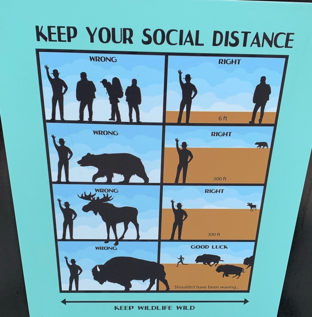
If only people could follow this; Yellowstone had by far the poorest mask adherence of all the parks
Before heading in to our last Utah park, we spent the night in Moab. The RV Park we stayed in was decent, and we made good use of the pool to cool off after a long drive. Then we plugged our ride in and relaxed in the AC!
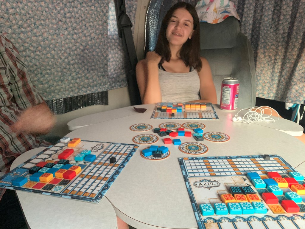
Kiddo crushed us in a game of Azul
Moab is apparently quite a biking destination and the business district reflects the popularity of the region. This was the first place we’d been to which had a real grocery store (with a Starbucks!) so we picked up some necessary provisions. We have a coffeemaker in the RV, but professional iced coffee is almost other-worldly good in 100+ degree heat.
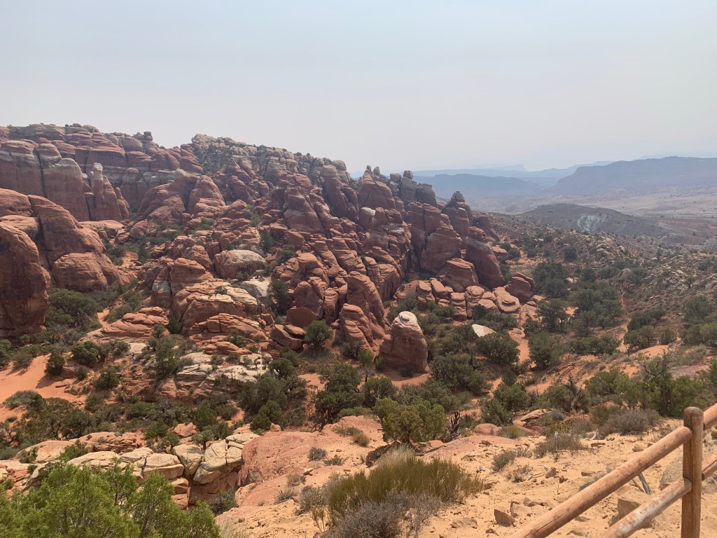
After a comfortable, AC-fueled night, we hit Arches National Park. Arches has the most modern feel of all the parks we’ve seen so far. It truly feels like it was designed for the car, with just some short, paved walks from clearly designated parking lots for activity. Normally there is the option to join a guided hike into the Fiery Furnace, but obviously not this year.
As with the rest of Southern Utah, Arches National Park is filled with rocky landscapes that are both awe-inducing and puzzling. Things can be both gorgeous and weird at the same time…not something I see much at home.
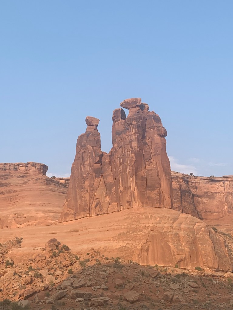
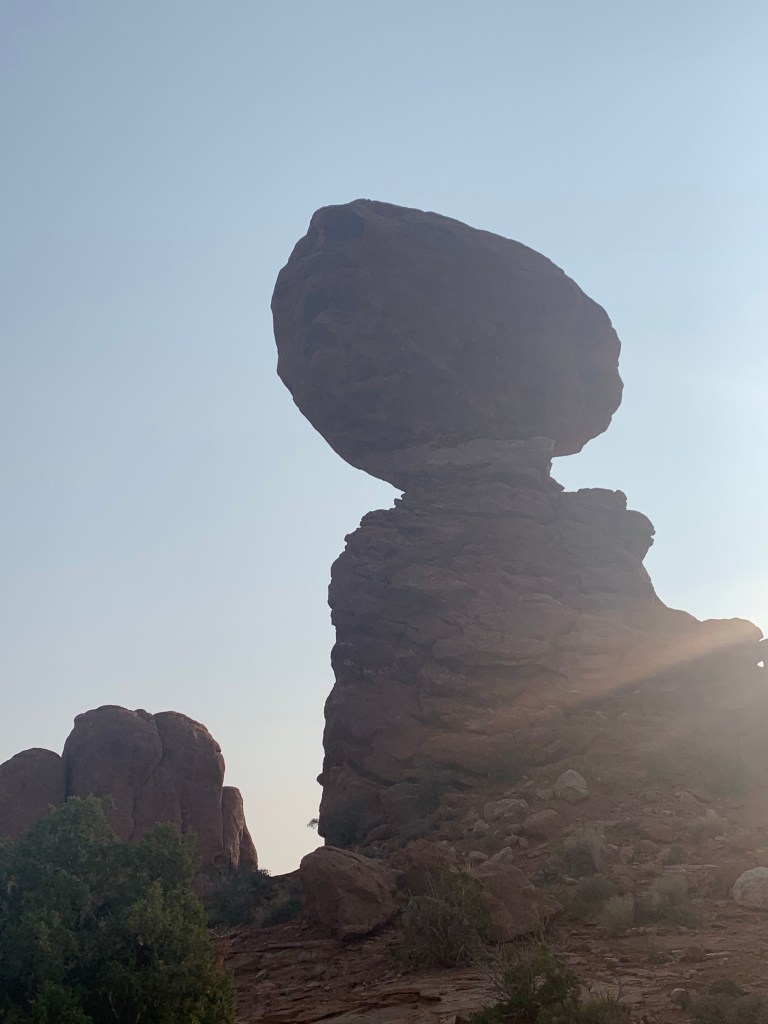
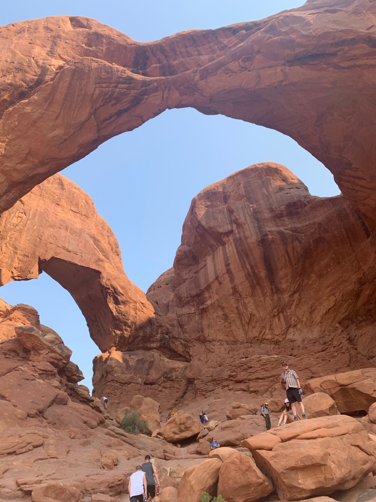
Three GossipsBalanced Rock is a 3600 ton chunk of harder rock sitting on a pile of softer rock which eroded quickerDouble Arch
There’s a lot less hiking in Arches which suited the family. We’d been clocking 8-12 miles a day for a while and I think there was appetite for a “duff day.”
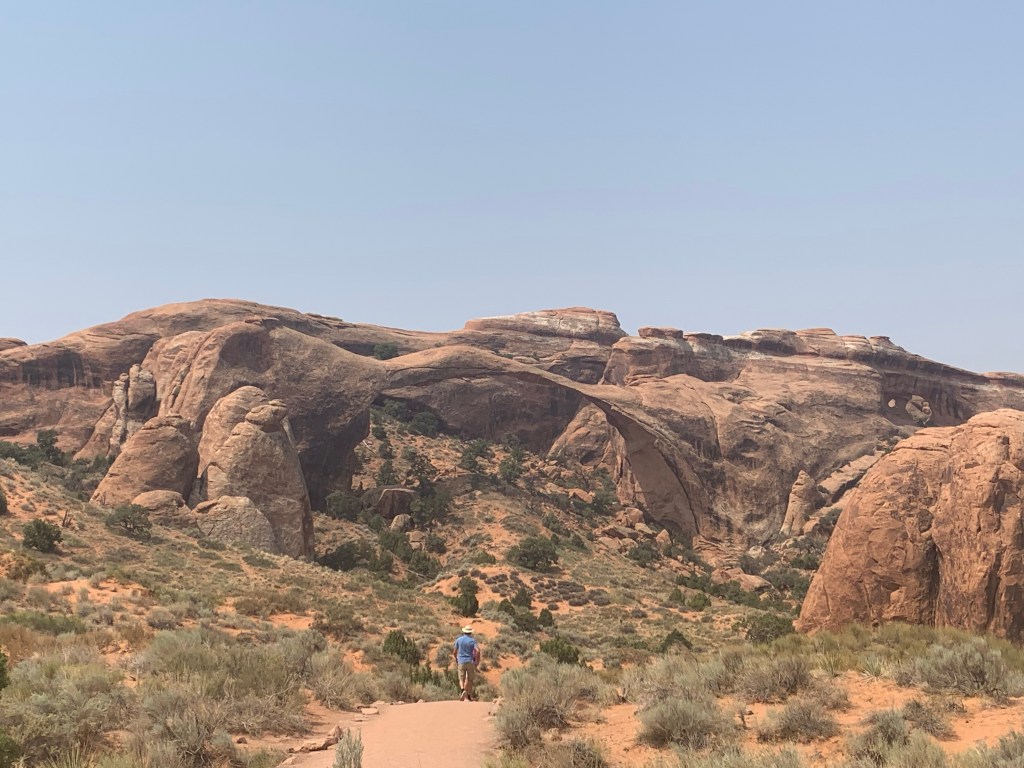
Landscape Arch, which is about the size of a football fieldFiery FurnaceA slot canyon, which would’ve been more impressive if we hadn’t been to Vermillion Cliffs as this was the entirety of the tiny canyon
I felt pretty medium about Arches. I think the 5th day of 100+ degree weather was a lot, and I was pretty worried about the car since it was still giving us trouble, but even more so I think the fact that the park is basically a series of parking lots that you drive through without any major change in scenery left me underwhelmed.
So the first half of the trip, I’d rank the experiences like this:
Vermillion Cliffs slot canyons (horrible to get to and a million degrees, but simply breathtaking once we got there)
Bryce Canyon (I appreciated the mix of cool hoodoos, hiking, and the relative quiet of the park)
Grand Canyon North Rim (nearly a tie with Bryce)
Arches (not bad, but I probably would’ve liked it more had I done it first rather than last)
Zion (in fairness, we didn’t see much of it because of the heat)
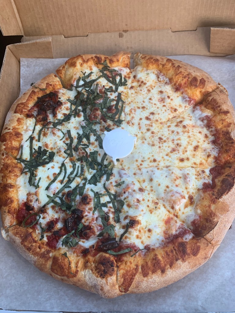
We left Arches and hit the road back to Salt Lake City. Long story short, we had to drop the RV off with the owner to have a repair made. He booked us a hotel in town for the night, and we made a trip out to Pi Pizza (as planned all along) since Anna-Sophia LOVES the pizza there.
Super thick pizza, with a perfectly doughy crust. Fresh basil and sun dried tomatoes for me; cheese for kiddo (of course)
The drive from Vermillion Cliffs wasn’t an easy one. We had some engine trouble that had us all on edge (thinking we would be stuck in Vermillion…some day a ranger would find our desiccated bodies on the side of the road, dried from the sun like human-sized raisins). Once we cleared the park, we had 3 hours of dry, hot, straight, boring highway through southern Utah and northern Arizona. Blargh.
Northern Arizona is not an engaging place to drive through
Luke **really** wanted to go to Monument Valley to see where nearly every classic Western movie was filmed, so I built the itinerary to accommodate (so rarely do my travel companions have preferences that when they do voice one I pay attention). It was thus disappointing to find out a few weeks before we left that the Navajo Nation was closing all of its parks in an effort to reign in the pandemic. I get it, and I totally support their objectives, but it was also sad because we’d come all this way and were eager to spend some money on the reservation.
We spent the night in an RV park on the Navajo Reservation. It was interesting/saddening to see how strict the Navajo people were being regarding COVID. Curfews are in place overnight so it isn’t that lively right now. We were supposed to stay at a camp inside the Monument Tribal Park but that was cancelled so instead we found ourselves at a cheesy, commercial enterprise that had arbitrarily restrictive policies. No shower after 5pm but the pool is open until 7? I’m sorry, but that means 3 incredibly sweaty, stinky people in my party used the pool to remove the first layers of gross. The RV park was basically a gravel yard. Not great, but it got the job done.
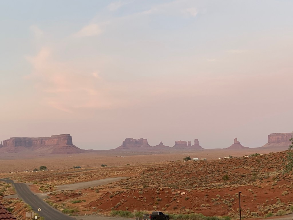
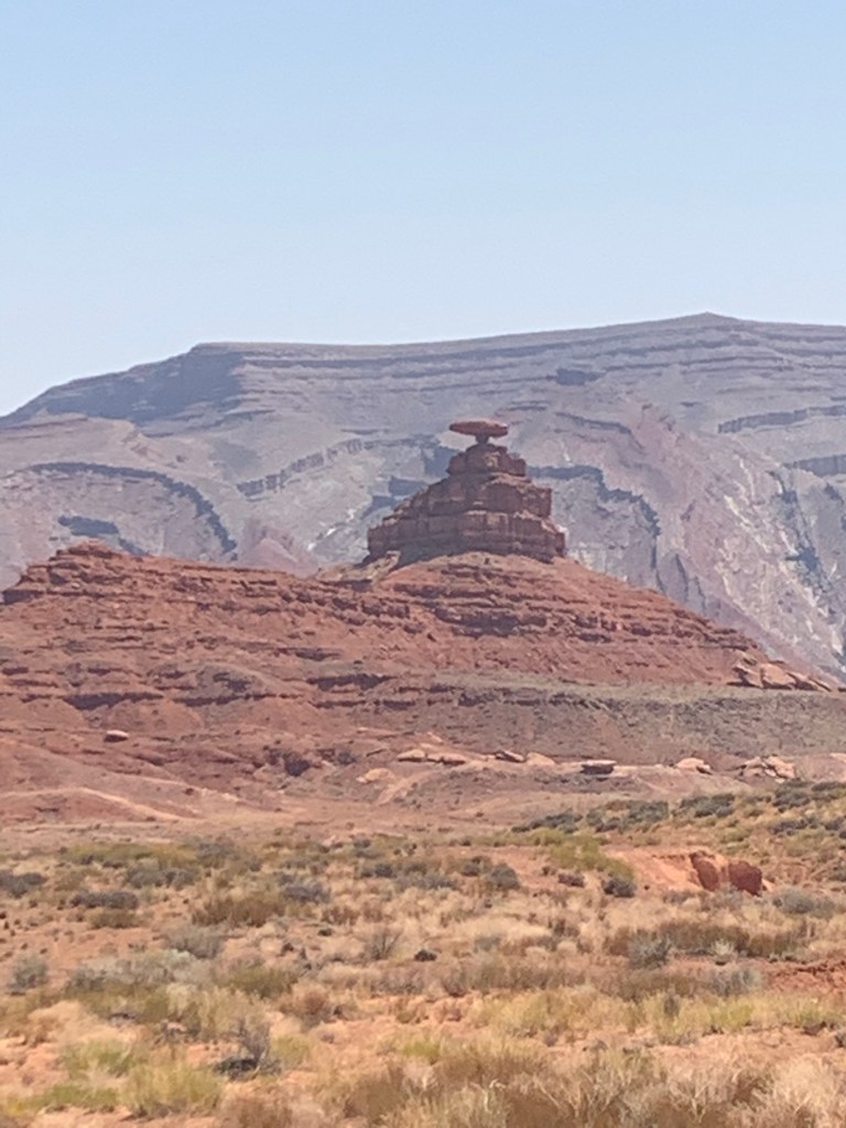
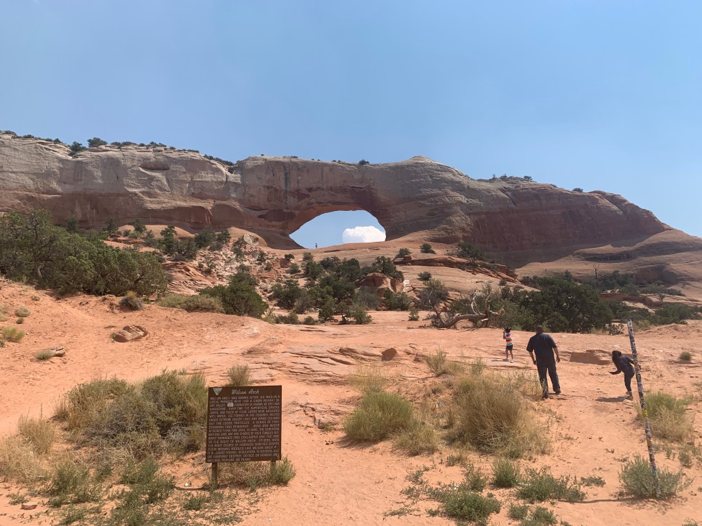
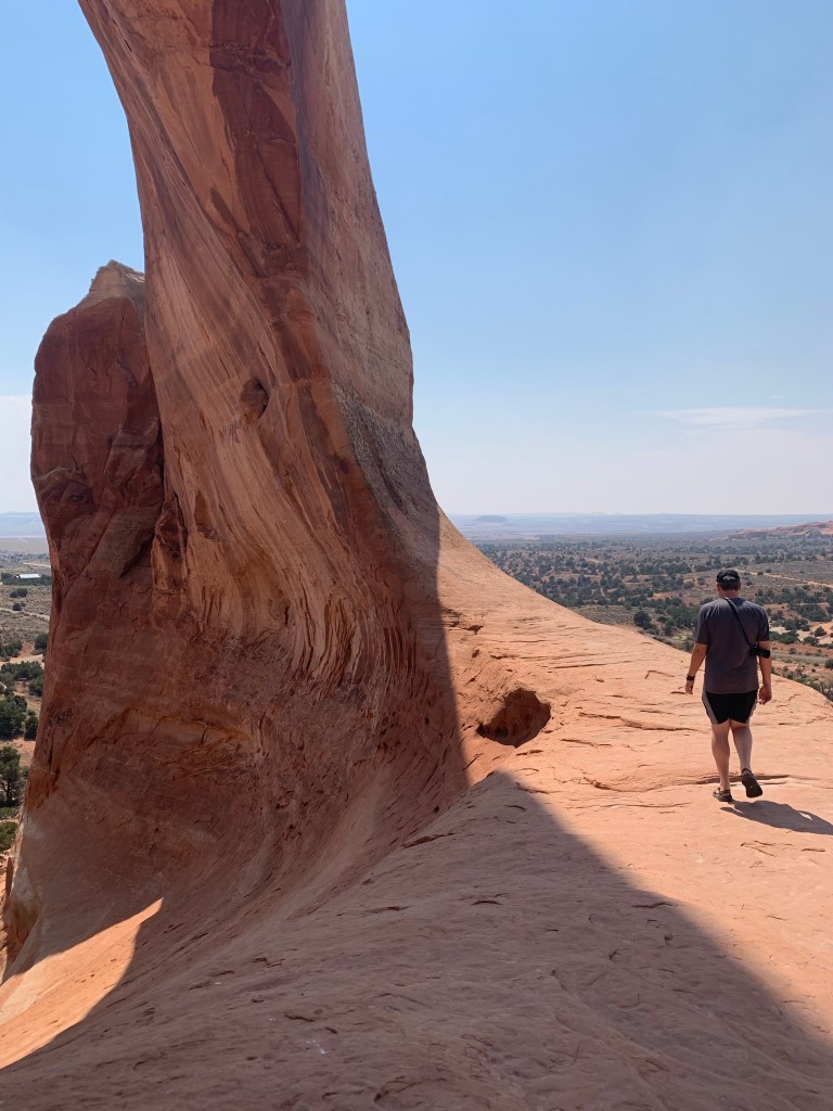
Monument Valley, from afarMexican Hat, in the town of…Mexican HatWilson Arch, randomly on the side of the highwayView from inside the arch
Next up – and last in Utah – was Arches National Park. To be continued…
That’s what Luke and Anna-Sophia tell me with some regularity. Today was no different.
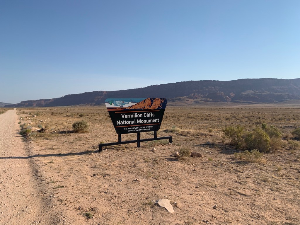
As I read the guidebooks and websites during the trip planning phase, I came across some photos of the geological features of Vermillion Cliffs National Monument and I was hooked. Vermillion Cliffs sports an undulating, striated stone formation called the Wave. The hike to it is long and it involves a lottery system for permits – so that wasn’t a go for us. But nearby are several similarly striking hiking trails that called to me.
Wire Pass to Buckskin Gulch is a 2.3 mile hike (each way) that goes through several slot canyons. I did read that the road to get there was rough and that there’s an obstacle at the start of the slot canyon, but otherwise this was a pretty easy hike that was worthwhile. I knew that after doing 5 miles of hiking the day before this idea wasn’t likely to land really well, so I sort of glossed over the details when explaining it. “We’re going to walk through a slot canyon.”
The road was horrible. And since we came from Arizona, it was 22 miles of horrible. We went super slow and made it, eagerly exiting the vehicle when we arrived. So eager, in fact, that we thought nothing of the heat.
Vermillion Cliffs and Grand Staircase-Escalante National Monuments sit side-by-side along the Arizona and Utah border
After walking a little over a mile fully exposed to the sun through a wash, we finally see the canyon entrance. At first it isn’t that impressive and so I’m pretty sure Luke and Anna-Sophia are wondering why I brought them all this way for this (and possibly contemplating whether or not to turn around and leave me there).
Luke, likely reflecting on why he lets me plan vacations
But just a few hundred yards later, the real reason for this trip is revealed and the likelihood that I’ll witness mutiny decreases.
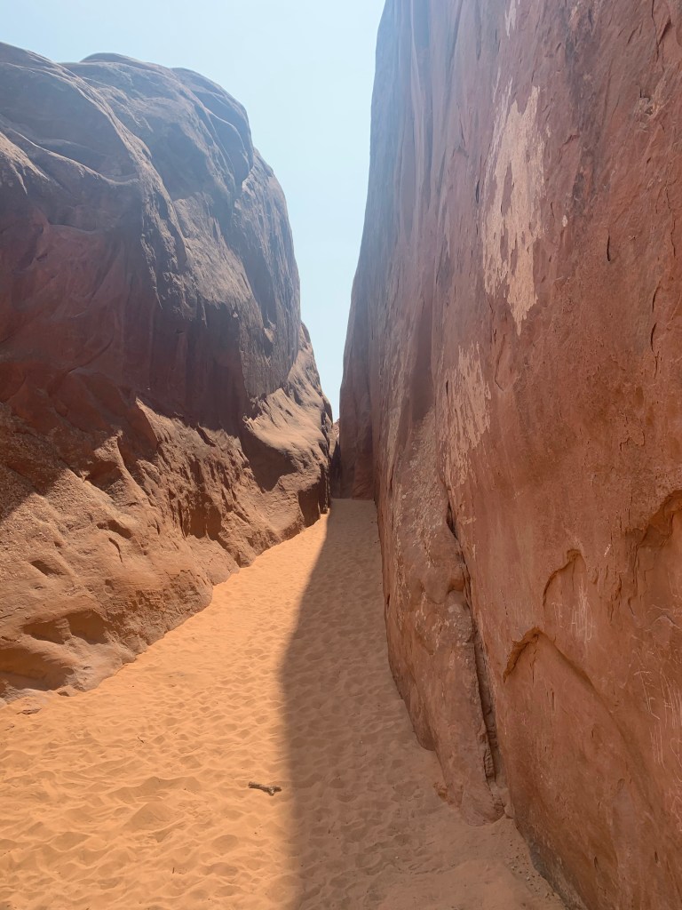
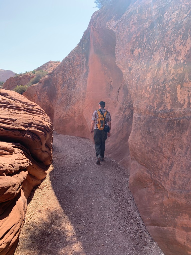
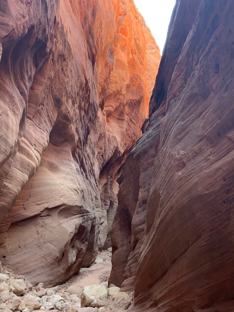
Entering the slot canyon
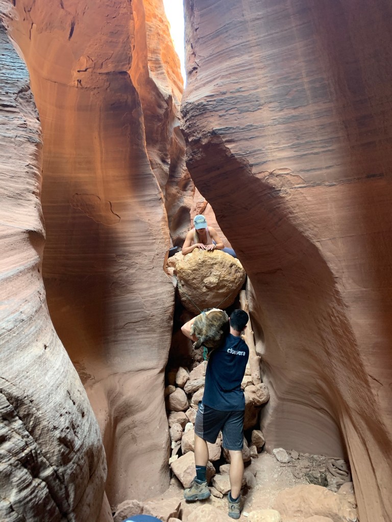
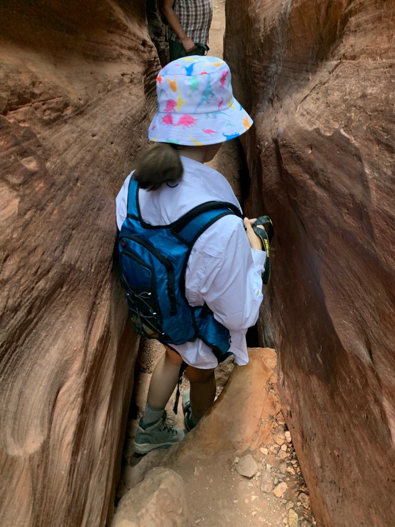
Before we could get into the depths of the canyons, we need to navigate the “obstacle.” This is a 10 foot drop with no permanent anchors or toe holds. There is a log wedged in under one side and some stones, but navigating this takes some strength, luck, and willingness to suppress the part of your mind that says this is a bad idea. Going down is easiest on your belly, but even that is tricky because the large stone at the top sticks out over the log so you can’t see what you’re doing and have to almost over-extend yourself. We made it down with no injuries, I’m pleased to report.
Some folks navigating the obstacle (with a dog!)
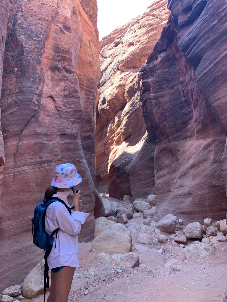
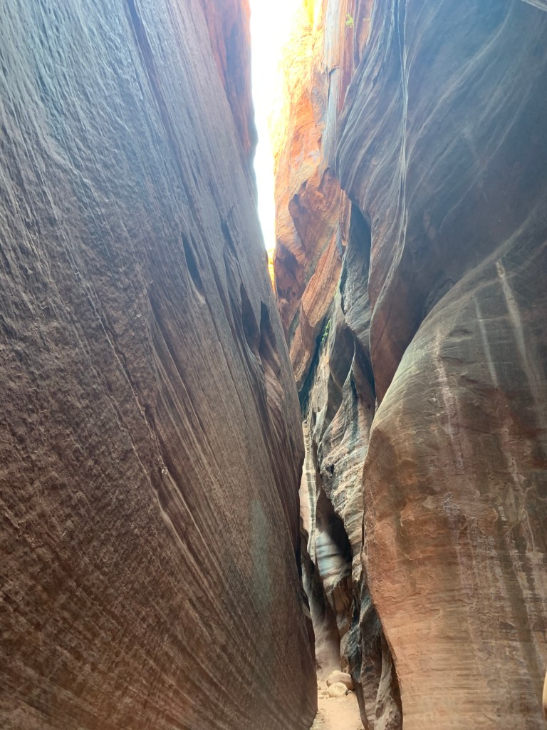
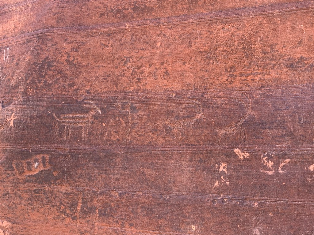
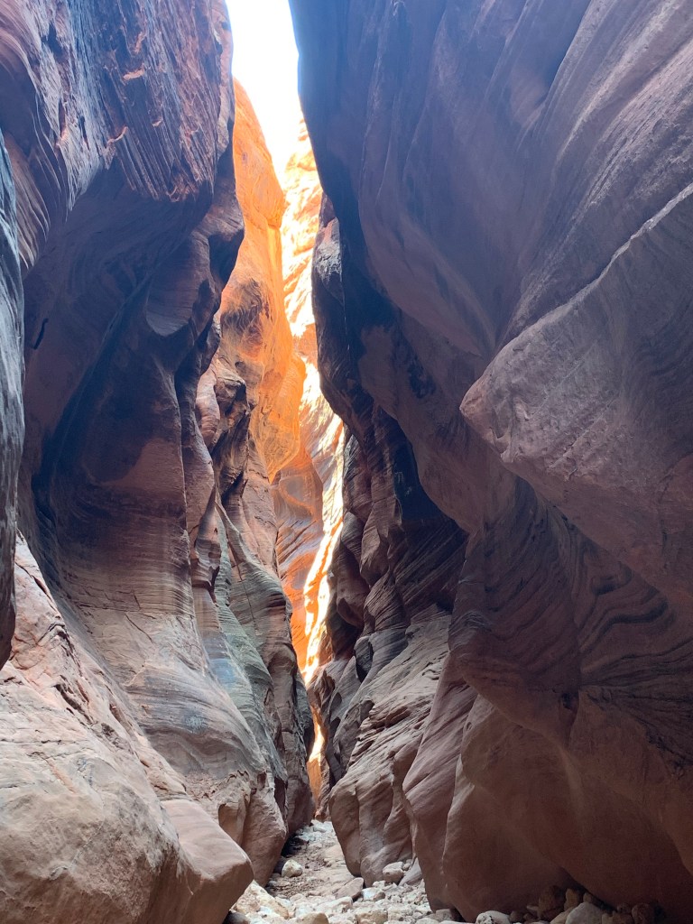
It was totally worth it. The next mile of walking was in this slot canyon. Between the colors and textures of the massive rock formations on our sides, the petroglyphs that adorned one section, the texture of the dried mud at our feet, and the captivating way the small bits of sunlight slid through the canyon at the top, this was an experience unlike any other.
It is really narrow in parts!Petroglyphs The big fire that swept through the forest also burned the land above the canyon, blowing ash into the canyon
By the end of the canyon, I had some devoted followers. I definitely cashed some of that devotion in when we had to navigate the obstacle on the way out (pro tip: bring rope to make a toe-hold or ask for help from other hikers) and for the walk back through the wash in 105 degree sun, but I think the balance is still in my favor as I still have 2 companions ready and willing to see what I’ve got planned for the remaining 10 days of this trip. 👍🏻
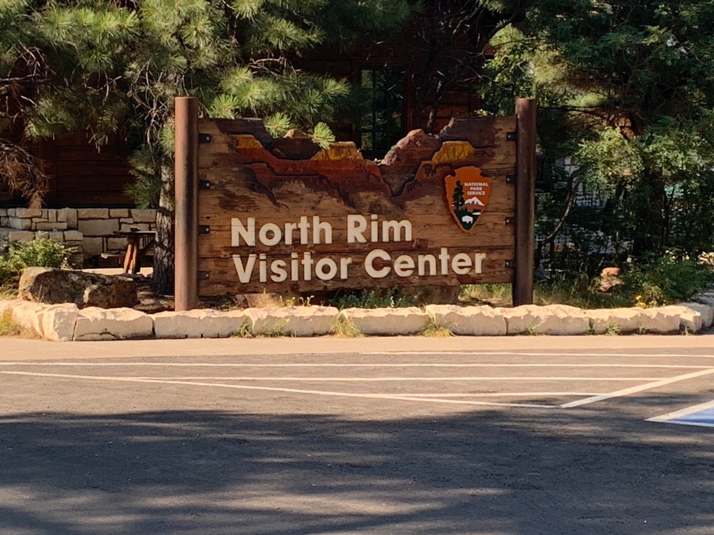
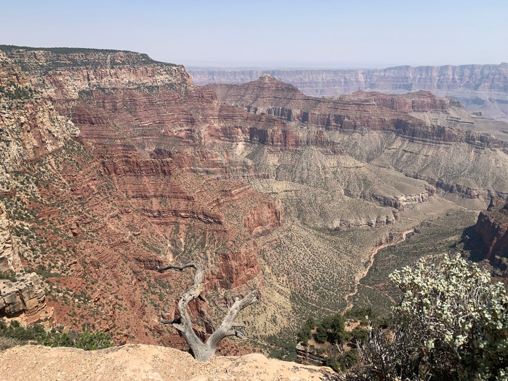
Why did it take me 40+ years to make it to the Grand Canyon?!
Only 10% of the Grand Canyon’s visitors go to the North Rim
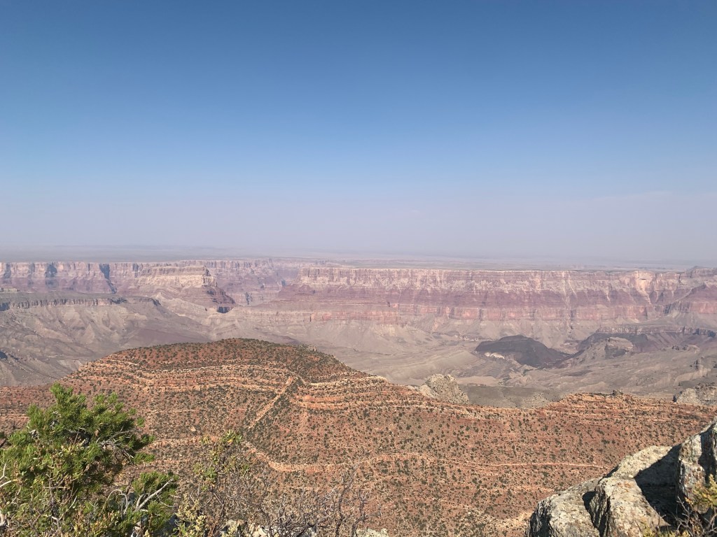
I guess I thought the Grand Canyon was a single, big canyon. In fact, it is a network of layered canyons sporting countless textures and colors that go on for as far as the eye can see and then some. The view from the visitor center alone was enough to justify the trip.
View from the visitor center
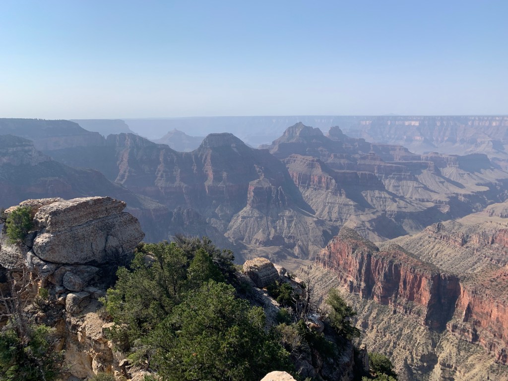
We did the scenic drive along the North Rim, stopping first at Point Imperial – the highest elevation in the park. This was just a vista opportunity, so we also had lunch here. For the record, I find it oddly enjoyable to turn the seats around and put the table in to convert the van into a lunchroom.
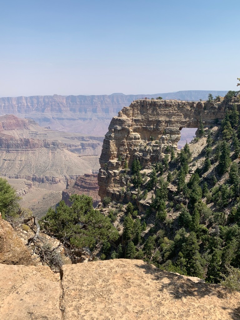
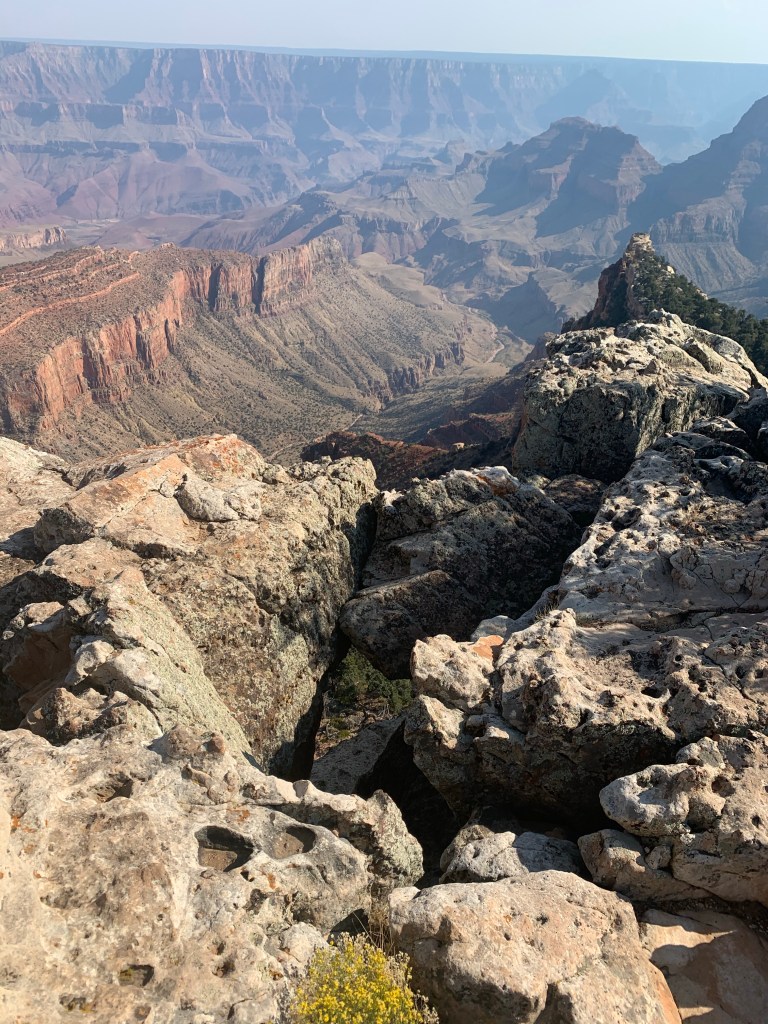
Then off to Cape Royal at the far eastern end of the North Rim Park. Here there were some easy “hikes” that also presented grand views of the canyon below.
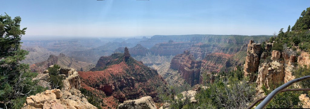
Perhaps the highlight of the day, however, was the Cape Final hike. This was a 4.3 mile (round trip) hike that wasn’t technically challenging, although any long walk at the end of the day can feel like a lot. Our book said that this hike was all about the destination and that was not a lie.
Cape Final
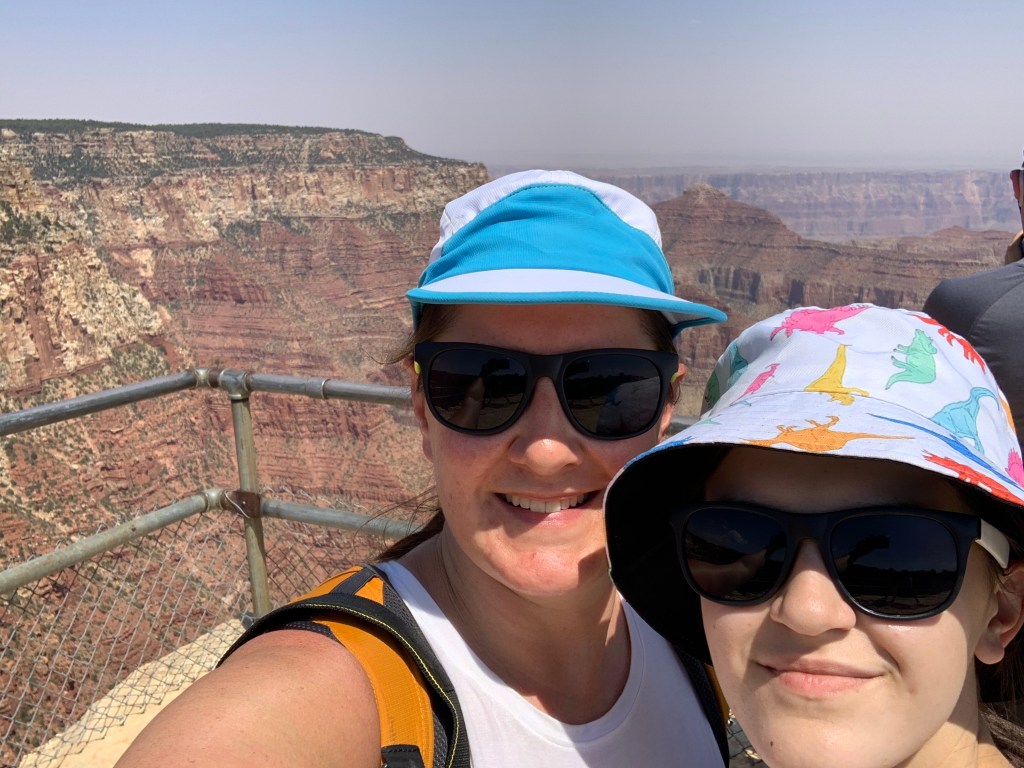
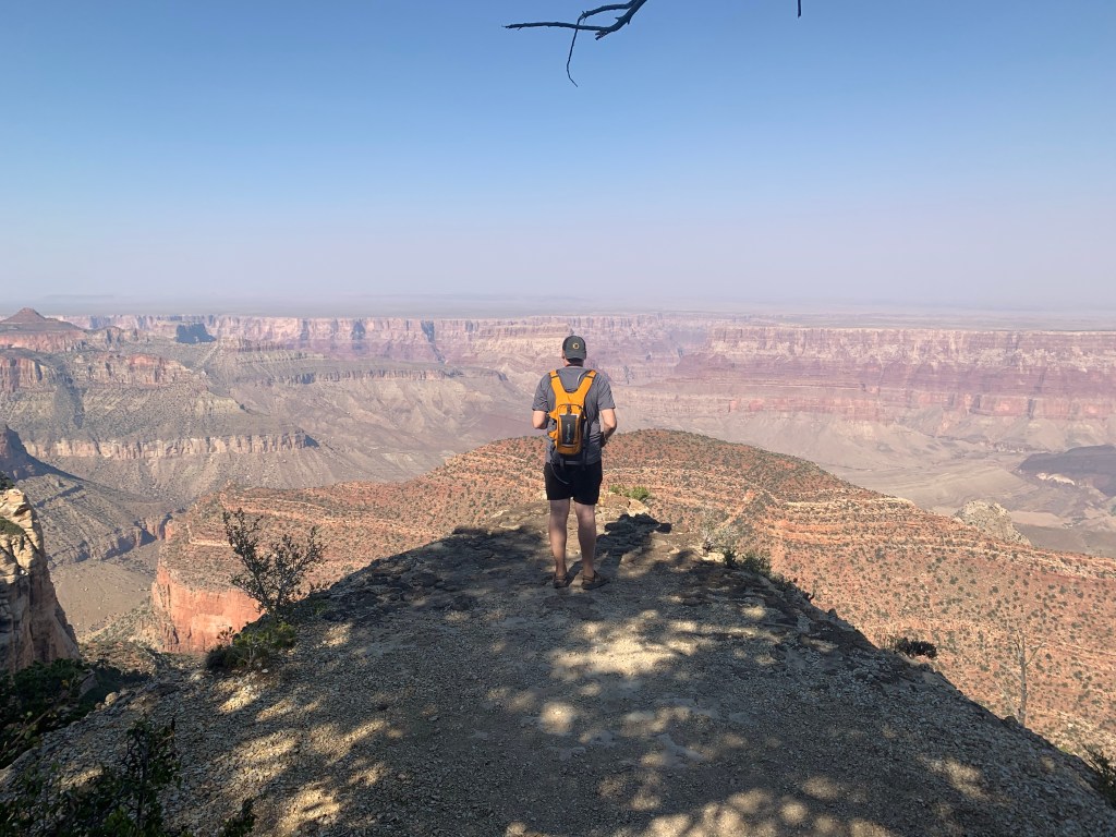
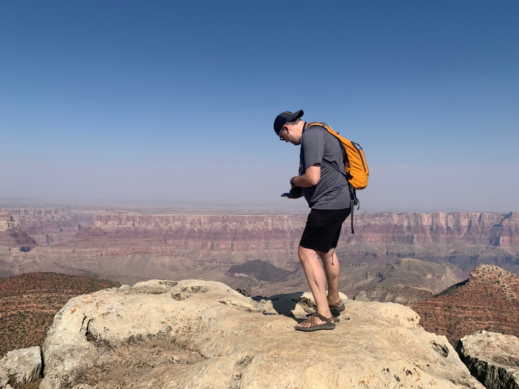
No guardrails. That’s what struck me the most about this place…usually American parks have guardrails, warning signs, danger markers, and any other number of things to protect those among us who lack any good sense or self-preservation instinct. On this hike, however, we could quite literally walk to the edge of the precipice and look a mile down into the canyon below.
Luke looking over the edgeThe edge of Cape Final is cracked and rugged enough to deter me from getting closerView from Cape Final
Part of the joy of traveling during a time when many others are afraid is that we have more space. There are fewer people around, and a large percent (but not all) are good about masking and distancing. These parks are made even that much more enjoyable by the space and privacy.
Coming from relatively densely-packed communities, I’m not used to driving through empty landscapes. The total lack of anything strikes me as foreign every time I encounter it. I’m not sure I could ever get used to this.
From Salt Lake City to Bryce Canyon the drive was an 80 mph blur through cattle ranches and open plains. Not exciting, but not terribly different than some other rural places I’ve seen.
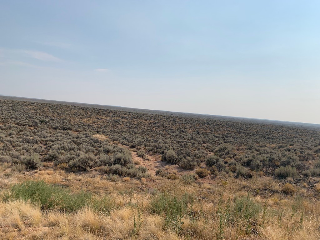
After leaving Zion, there was a lot more nothing,
A whole lot of nothing
As we approached the Kaibab National Forest, the landscape did begin to change. First, we gained some elevation so prairies turned toward rolling hills. There were trees – mostly thin pines, but also a heavy sprinkling of birch – that grew denser as we continued southeast.
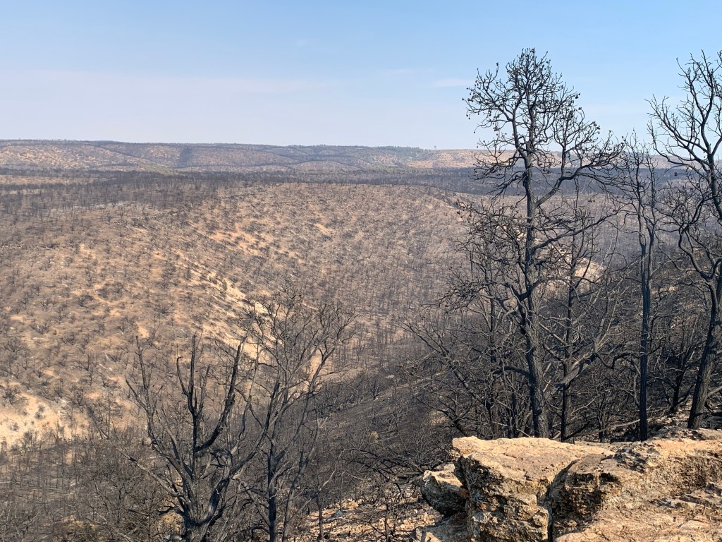
Then we saw the remnants of the fire.
I didn’t know that this forest recently experienced a substantial fire. The Mangum fire burned 71,450 acres of forest this summer, resulting in a landscape that is a different kind of nothing. While the earlier parts of Arizona had nothing to look at – like a beige wall – the land scarred by the fire had just enough present to indicate that you were missing the complete picture – like when a picture taken off the wall leaves an outline. You know something better was there, but you can’t see it.
This hillside is covered in charred tree skeletons
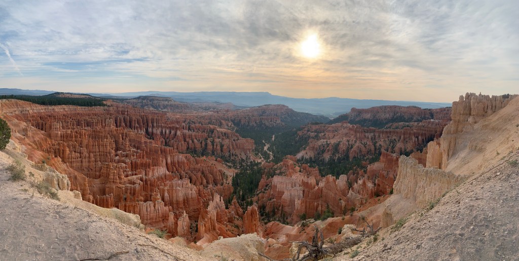
Zion National Park has to be one of the hottest places on this planet. We had been warned, so we changed our plans for the day. Rather than spending the night in Zion, we instead spent the night outside Bryce Canyon so that we could hit the last sights in the morning with the early morning sun. We basically had the place to ourselves, which adds to the magic of the experience.
Bryce Canyon, early morning
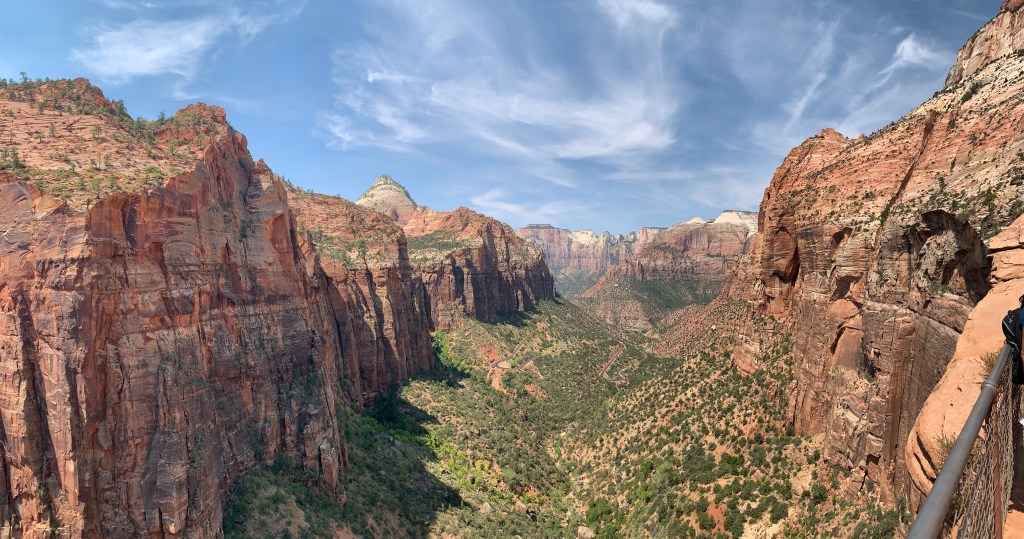
After a few last stops in Bryce, we hit the road for Zion, taking the Zion-Mt Carmel scenic highway 9. No photos there since I was driving. Just before the Mt. Carmel tunnel, there is a Canyon Overlook trail that we wanted to do…before it got too hot.
This trail was crowded, and mostly with people who didn’t adhere to masking/social distancing rules. And it was hot. Still, pretty cool sights…
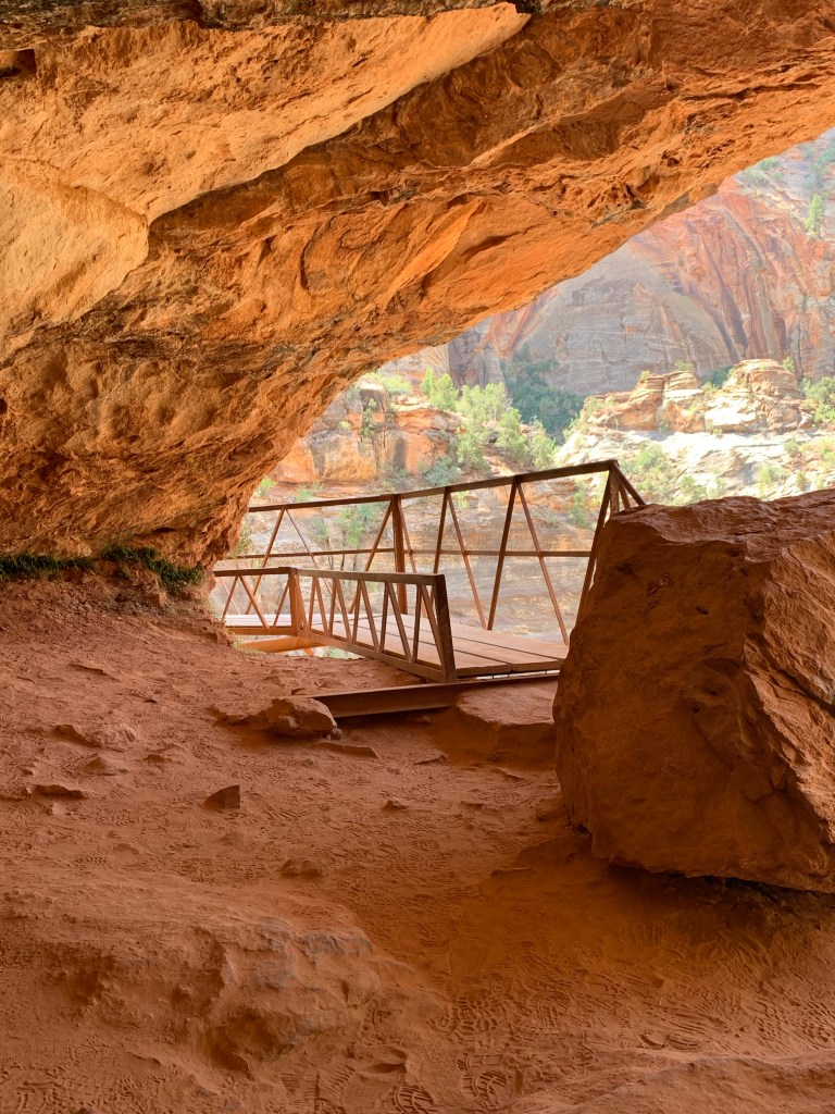
Desert Bighorn SheepZion CanyonI felt pretty medium about this bridge
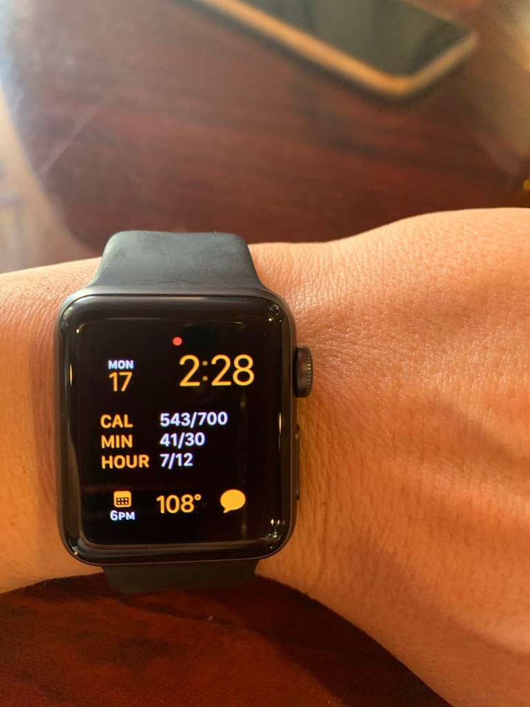
After the hike we hit the visitor center. We planned to drive back out on the same road and then find a spot in the Kaibab National Forest in Arizona to camp, but the heat really did us in. We sought a restaurant for lunch with air conditioning (we even ate inside!) and reconsidered our plan. At this point, we were all sweaty, tired, cranky, and just desperate for a cool shower, clean clothes, and a place to sleep that wasn’t in the triple-digits. How people live in these climates is beyond me. Dry heat or not – 108 is too hot for humans, period.
Yup, that says 108.
After some deliberation, a gallon of ice water each, and some much-needed food, we opted to just ditch Zion and head to AZ. The crowds and the heat combined to leave us a bit disappointed, especially after the fabulous experience we had in Bryce. Well, can’t win them all!